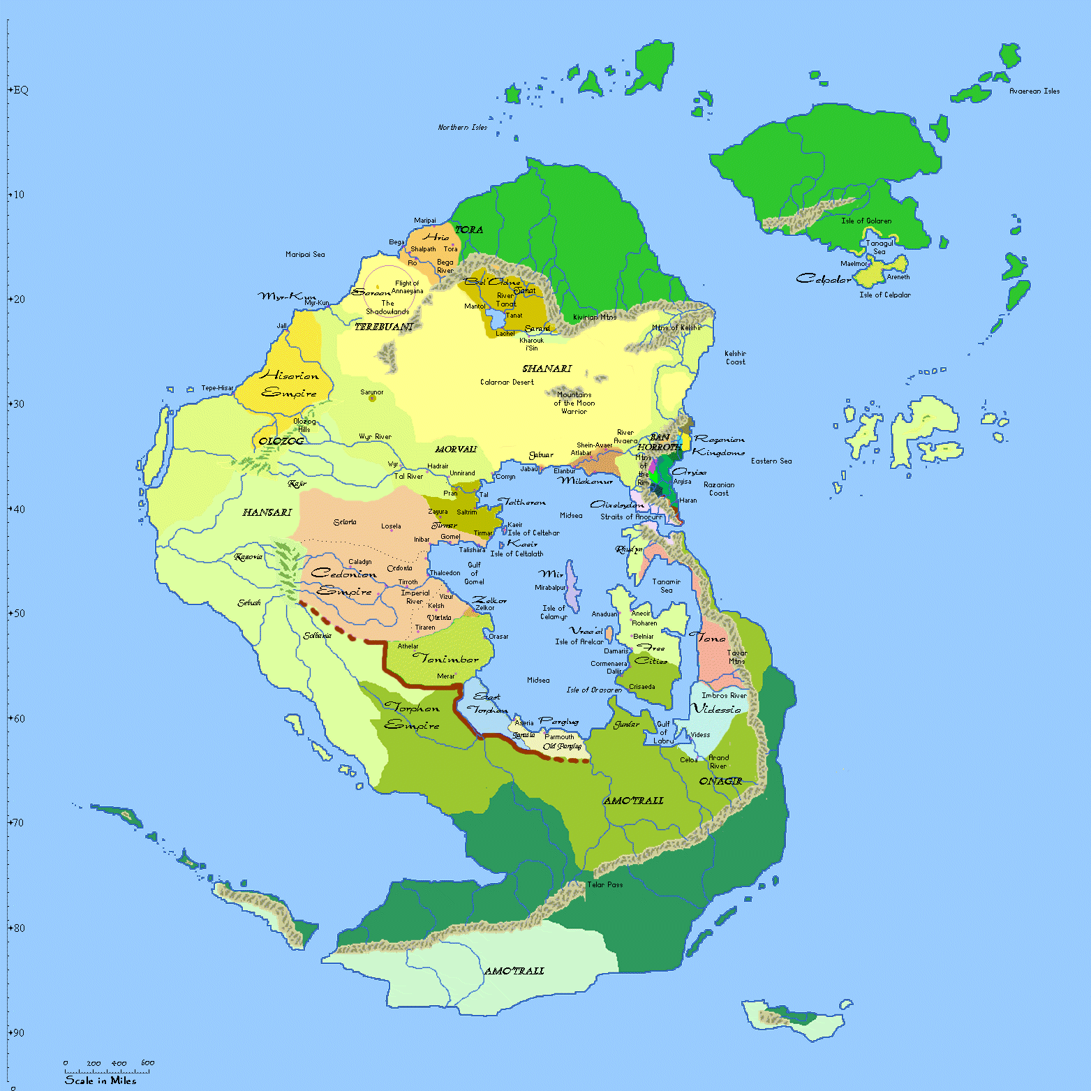
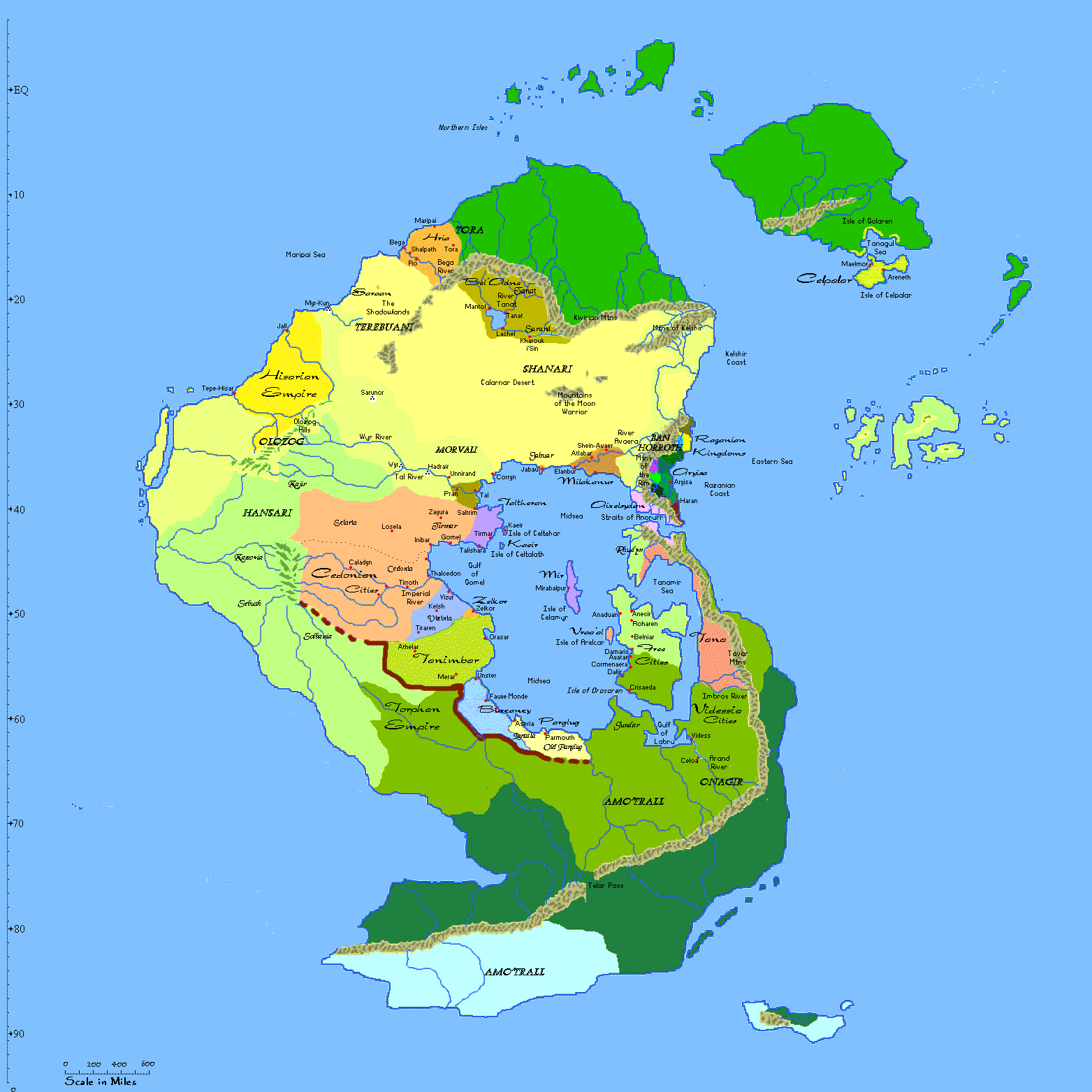
Map of Qaiyorean Societies 1412 Map of Qaiyorean Societies 1428 Click on the
map below to zoom in. Click on the
map below to zoom in. Information on the
world of Celandra Circumference at equator: 27,000 miles Mode of Travel
Map of Human Spoken Language
Families on Qaiyore
Close-up maps of the
Razanian Coast and Asagmar
The Cedonian Empire c700
Information
on the world of Celandra
Distance: 10 degrees lattitude/longitude = 750 miles
Travel times: 25 miles/day walking over level ground
Distance
Conditions
Walking or riding
25 mi/day
plains, roads
Walking or riding
15 mi/day
hills, forest
Walking or riding
10 mi/day
mountains, jungle
Forced march or ride
50 mi/day
plains, roads
Forced march or ride
30 mi/day
hills, forest
Forced march or ride
20 mi/day
mountains, jungle
Sailing
150 mi/day
normal to heavy winds
Sailing
100 mi/day
light to normal winds
Sailing
50 mi/day
slight winds